
Map of Faroe Islands
Jump to chapter
Published: 03/06/2021
Reading time: 6 minutes
Where can you find the Faroe Islands on a map? The Faroe Islands are 18 rocky islands in the wild North Atlantic Ocean nestled between Iceland, Scotland, and Norway. This archipelago in the outskirts of Europe is a natural masterpiece and a vastly untouched place on earth.
- Dip into Faroe Islands’s largest wealth of Self Drive Tours
- Book your Car Rental in Faroe Islands and explore the islands at your own pace
- Browse and find a Vacation Package in Faroe Islands
- Discover What to Pack for Travel in Faroe Islands
On maps of the world these islands are marked as tiny little dots, if they appear on your map at all. A more intimate acquaintance with the Faroe Islands reveals a stunning world with an unbelievable setting all of its own.
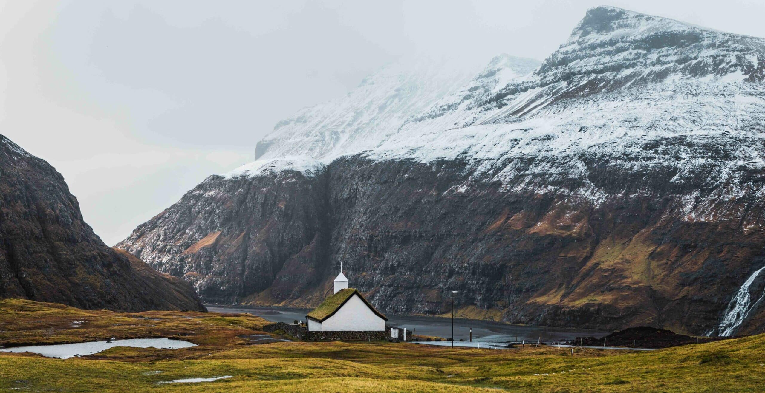
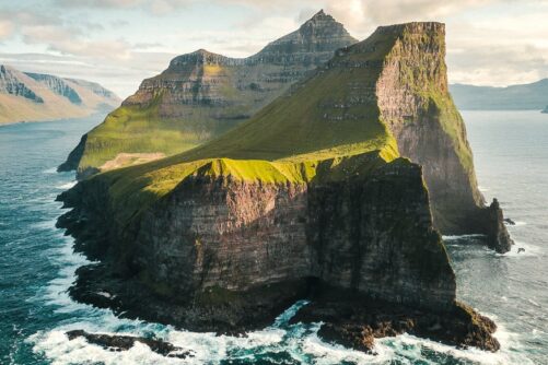
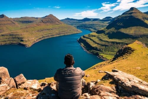
Awe-inspiring mountains surround the islands with breathtaking sceneries all over the place. One of the best kept secrets and unspoiled wonders. The Faroe Islands are easily the most moodily beautiful place on earth.
Where is Faroe Islands?

Tucked midway between Iceland, Scotland, and Norway in the North Atlantic Ocean, the Faroe Islands are a craggy cluster of 18 mountainous islands. The Archipelago is situated at 62º latitude north and 7º longitude west.
These volcanic islands are located northwest of Scotland, east-southeast of Iceland, and west of Norway. These are the distances from the Faroe Islands to its nearest neighbours.

- Scotland 400 km (250 mi)
- Iceland 460 km (285 mi)
- Norway 580 km (360 mi)
The Faroe Islands has a land area of 1,399 square kilometres (540 sq mi). The archipelago has a sea area of 274,000 square kilometres (105,792 sq mi). Thus, more than 99% of the Faroe Island’s total area is ocean.
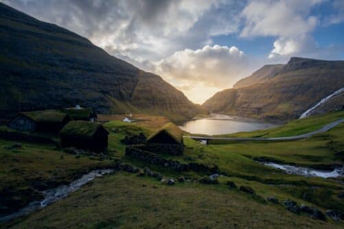
Narrow sounds and rapid currents divide the islands. Faroe Islands or Føroyar consists of high mountains traversed by deep valleys, countless waterfalls and narrow fjords.
Faroe Islands on Map

The contours of the northern mountains are dark, and rough, while further south the shape of the landscape grows softer and ravishing pastures become larger and seem more friendly. The Faroe Islands are still untouched by mass tourism.
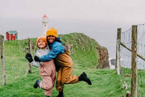
Even during high season between May and September you can find yourself almost alone when exploring the popular attractions in the Faroe Islands. With its remote location, this is the ideal vacation for those looking for quietness and roads less travelled. The total population in the island group is merely 55,000 people.
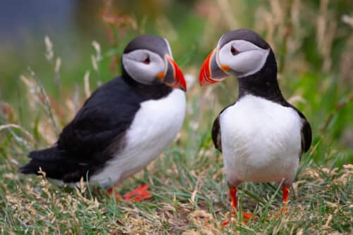
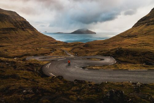
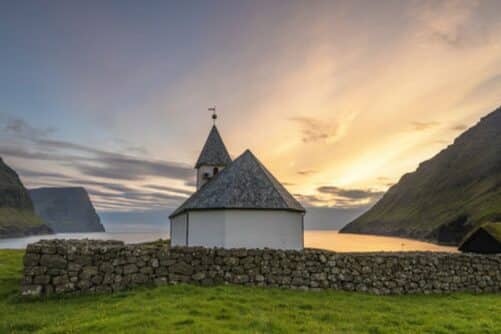
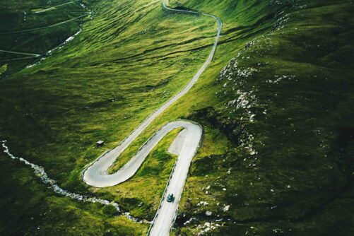
Travelling in the mountainous Faroe Islands is easy as roads, bridges, tunnels, ferries, and sub-sea tunnels connect the islands. Coastal cliffs, small villages, lighthouses located at the most exotic places, seabirds, and stunning waterfalls attract nature lovers to these islands.
There are in total eighteen islands in this archipelago in the North Atlantic Ocean. When you also take into account all sea stacks and other islets near the coastline then there are hundreds of breathtaking rock formations.
It is always helpful to look at a map when planning your holiday to the Faroe Islands. On the map below you will find all ferry routes and you can see where the only airport in the Faroe Islands is located.
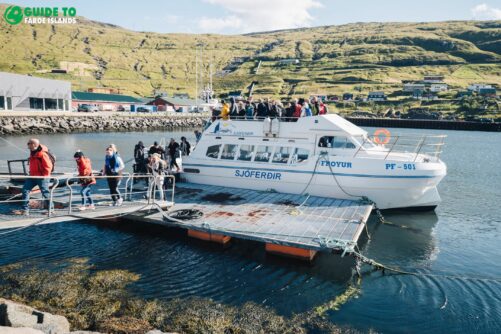
This is a need-to-have map when travelling in the Faroe islands. Seven out of eighteen islands are connected and the other eleven islands can be reached either by ferries or by public helicopters.
Map with Ferries and Buses

This map of the Faroe Islands shows you all the main roads. There are also many smaller and narrower roads leading especially to the smaller villages such as Saksun and Tjørnuvík. You can also see all the helicopter landing sites and bus routes.
The Environment Agency in the Faroe Islands offers free maps and geodata online. Make sure to check this interactive map where you can add different layers and browse the Faroe Islands. There is a great topographic map on the site and even a map of the Faroe Islands from year 1900.

If you want to inform yourself more about ferry transport between the islands then visit Strandfaraskip Landsins. It is the national domestic transport company.
You will find all prices and timetables on their website for both ferries and public busses between islands and villages in the Faroe Islands. All ferries run all year round except the one to Mykines Island.
Attractions in the Faroe Islands
One of the most popular lighthouses is the iconic lighthouse on the southernmost tip of the Faroe Islands. The lighthouse is perched at the end of Suðuroy Island.
- Find your Guided Tour to Suðuroy Island
This is one of the most isolated places in the Faroe Islands and the most common sign of life to see here is a rich birdlife. Suðuroy Island is the perfect destination, if you want to slow down and recharge.
The sight is striking. The lighthouse has been a warning beacons and has helped seafarers find their way to safe harbour. Now this place attracts people finding inner peace in these gorgeous surroundings. Immerse yourself in these stunning settings.
When people hear of the Faroe Islands for the first time, their initial question is usually: Where are the Faroe Islands located? This is totally understandable as these islands are still undiscovered.
Now you have got the right answer to this burning question. Why not dig into the many exciting Faroe Islands tours bookable just a single click away.
More articles

Popular tours
-

The 5 Day Photography Tour | Faroe Islands Highlights
Tour startsTórshavnDuration5 days -
Beautiful 8 Hour Tour to Mykines Island
Tour startsTórshavnDuration8 hours -
Thrilling 7 Hour TROM Sightseeing Tour
Tour startsTórshavnDuration7 hours -
Spectacular 8 Hour Streymoy Island Day Tour
Tour startsTórshavnDuration8 hours -
James Bond Highlights
Spectacular 7 Hour Kallur Lighthouse Day Tour
Tour startsTórshavnDuration7 hours -
Captivating 12 Hour Tour to Suðuroy Island
Tour startsTórshavnDuration12 hours -
Private Escorted Tour of main Faroe Islands
Tour startsStreymoy IslandDuration6 hours -

Engaging 2.5 Hour Tórshavn in a Seashell Tour
Tour startsTórshavnDuration2.5 hours -
Norðradalsskarð, Sornfelli & Kirkjubøur | Private VIP Tour
Tour startsTórshavnDuration2 hours -

Exceptional Afternoon Boat Cruise From Tórshavn
Tour startsTórshavnDuration4 hours -
Spectacular 7 Hour Eysturoy Island Day Tour
Tour startsTórshavnDuration7 hours -
Vibrant 4 Hour Viðoy Island Tour
Tour startsTórshavnDuration4 hours -
Private Tour With Filmmaker as Guide
Tour startsTórshavnDuration5 hours -

The Grand 10 Day Faroe Islands Tour Package
Tour startsVágar AirportDuration10 days -
Refreshing 3 Hour Boat Tour including Fishing
Tour startsKaldbaksfjørður FjordDuration3 hours


Other interesting articles


