Vagar Island | The Ultimate Guide
Jump to chapter
Published: 03/06/2021
Reading time: 11 minutes
What is there to experience on Vágar Island? Which attractions are the most stunning on the island? And how can you explore all the sights that you truly want to see? Read on to learn everything you need to know about Vágar Island.
- Find the largest range of Mountain Tours here
- Book a Vacation Package in the Faroe Islands
- See all Tours on Vágar Island here
- Discover the widest selection of Car Rental in the Faroe Islands
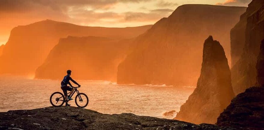
Located in the western part of the Faroe Islands, Vágar Island holds a special place in the hearts of travellers. There are so many amazing nature attractions on Vágar Island that this isle is a travel destination in its own right.
Vágar Island is home to Vágar airport. Everyone coming to the Faroe Islands by aeroplane will visit Vagar as there is only one airport in the Faroe Islands. It takes 45 minutes to drive from the airport on Vágar Island to the capital, Tórshavn.

Vágar Island is the third largest island in the Faroe Islands. The stunning island lies between Mykines Island to the west and Streymoy Island to the east.
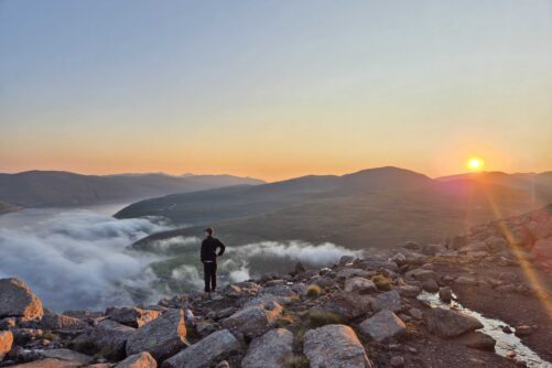
Being one of the most beloved islands in the Faroe Islands, Vágar Island has a wide array of sights to explore. Vágar Island is home to 50 mountains which are all quite easy to climb. This is your ultimate guide to Vagar Island.
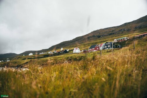
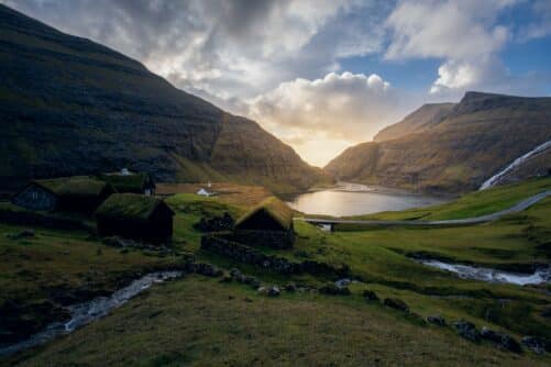
Villages on Vágar Island

There are six villages on the island. All settlements are located next to the ocean except one which is nestled along the lake next to the airport. These are the settlements on Vágar Island:
Gásadalur is the smallest settlement on the island with only 10 people living there. Miðvágur and Sørvágur are the largest villages. Both villages are similar in size with just over 1000 inhabitants in each.

In an eastern direction lies the Vestmannasund strait, which separates Vágar Island and Streymoy Island. These two islands are connected by a 5 kilometres (3.1 miles) underwater tunnel.
In the southern part lies the Vágafjørður fjord, which separates Koltur Island and Vágar Island. You will find the Mykinesfjørður fjord on the west side of the island, which separates Mykines Island and Vágar Island.

When in the settlement Bøur, you will see both Mykines Island and Tindhólmur Islet and Gáshólmur in a westward direction. Tindhólmur is is an impressive sight with its spiky formation.
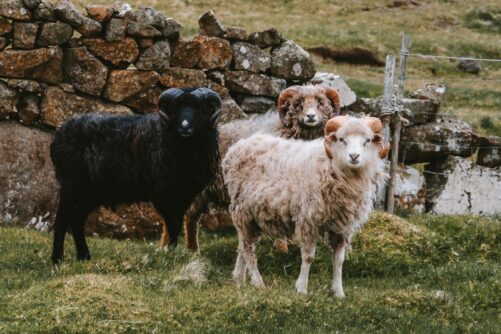
Sheep roam freely on Tindhólmur together with a rich birdlife. There are a handful of houses on the islet but no humans live on Tindhólmur.
Lakes, Waterfalls & More!

Gáshólmur is steep on all sides. Heavy surf has broken into the wall and the islet looks like an abnormally large wooden block. The islet is not a good place for birds to nest, but there are a few, though. The islet is flat and sheep grass here as they do almost everywhere in the Faroe Islands.
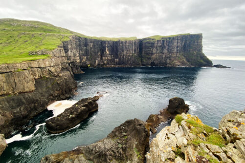
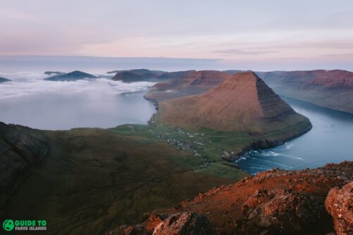
The island is 15 kilometres (9.3 miles) long from the most northerly point Slættanestangi to the souternmost point which is the famous Trælanípa Cliff. The westernmost point is called Barðið, which is 22 kilometres (13.7 miles) from the most easterly point Búkonan.

The seaside is rugged and there is a large bay on the southeast side of the island, which divides further into two bays Miðvágur and Sandavágur. On the western side lies the deep Sørvágsfjørður Fjord.
You will find the valley Klovin in the middle of the island from Bøsdalafossur Waterfall on the south coast and north to Víkar on the north coast. In this valley lies the largest and second larges lakes in the Faroe Islands: Lake Leitisvatn and Lake Fjallavatn. These are both among the most beautiful lakes in the Faroe Islands. There is also a large pond between these lakes named Tjørnin í Ennið.
The Vágar Island Landscape

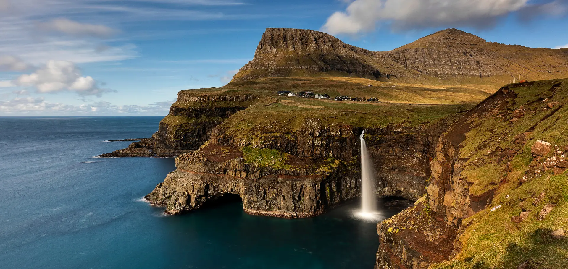
The highest mountains are found in the northwestern part of the island near Gásadalur. The island’s highest mountain Árnafjall elevates 722 metres (2368 feet) and Eysturtindur rises 715 metres (2346 feet).
Gásadalur is home to the famous Múlafossur Waterfall. This attraction’s instant beauty makes it the most photographed spot in the Faroe Islands.
You will also find quite high mountains in the southeastern part of the island. Here Malinstindur peaks at 683 metres and Reynsatindur at 677 metres.
There are several skerries and large sea stacks along the shoreline. Just east of Sandavágur lies Trøllkonufingur Rock Pillar which towers 313 metres (1027 feet) out of the ocean. The Faroe Islanders have some old legends about this remarkable rock formation. Some years ago, mountaineers managed to climb all the way up to the top of Trøllkonufingur.
On the west side of the Sørvágsfjørður Fjord lies two large islets, Gáshólmur, which is 65 metres (213 feet), and Tindhólmur, which is 262 metres (860 feet). Between Tindhólmur and Vágar lies the sea stacks Drangarnir; the larger one being the most famous due to its impressive mesmerising sea arch.
The outfields and steep cliffs have been the backbone of the people’s life here. Later, fishing became important for the villagers as well.
Fjords & Grassy Terrain

Vágar Island is reasonably grassy terrain. In the deep valley Klovin, you will find good agricultural land both north of Lake Fjallavatn and between Fjallavatn and Lake Leitisvatn (Sørvágsvatn). Suðurtriðingur, which is the land by Vágar Airport, is also flat and beautiful. You will also find flat areas in Gásadalur, Víkar, Prestland, Kvígandalur, Tjørndalur, Slættanes, Oknadalur, Úti í Botn and in Syðraseyð.
When looking at the landscape, you will also notice that the island is quite round shaped and hence a great place for horseback riding. The mountains are most round shaped and soft in the outlying fields in Sandavágur towards the Vestmannasund strait.
The more spiky mountains are Krosstindur and Reynstindur in the eastern part of the island, and in the western part of the island, the mountains Árnafjall and Eysturtindur are peaky like most mountains in the Faroe Islands. This reveals that, in the far past, ice once covered the whole island.
Klovin, which stretches from Reipsáfossur Waterfall to Bøsdalafossur Waterfall, shows how the glaciers have moved in the past. The ice has pushed its way through the island to Oyrar and Miðvágur. Two smaller glaciers have most likely pushed the ground from Sandavágshálsur to Sandavágur and then one from where the airport on Vágar Island is situated and down to Sørvágur.
High Mountains and Sheer Cliffs
Heavy cliffs shape the northern side of the island. This also goes for the western side and south side of Vágar Island.
You will see the cliffs in Sandavágur by Trøllkonufingur, in Miðvágur by Nípuberg, which Trælanípa Cliff is a part of, and in Sørvágur from Bøsdalafossur waterfall. The entire southern side of the area is known under the collective name Sørvágsbjørgini.

There are further cliffs from Bíggjarskor near the village Bøur to Gásadalur, and from Gásadalur to Barðið and to Víkar. Then from Reipsáfossur waterfall and all along the east cost to the Slættanestangi spit.
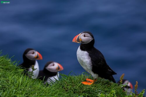
Vast nature reserves filled with precipitous terrain and piles of largish stones are everywhere around you when here. The steep hillsides are fat pasture for sheep. Enjoy nesting birds in countless numbers in this area. There are signs now that the bird population is growing in these unbelievable surroundings.
Accommodation on Vágar Island

There are lots of accommodation possibilities in Vágar Islands. Many locals are renting their basement apartments to visitors. There is also a hotel just a two minutes walk from the airport as well as a youth hostel, cottages and a boutique hotel.
You can stay in all villages if you like as there are rental options in all settlements even in Gásadalur at Gásadalsgarður. Travellers can put up a tent at Giljanes Camping during the summer months.
What to do and see on Vágar Island

It is easy to travel from Vágar Island to other parts of the country, especially due to the airport as all flights to the Faroe Islands operate from Vágar Airport. There are connecting busses to most flight arrivals and departures and there are lots of taxi drivers waiting at the airport when travellers enter the arrival hall.
You can also reach most islands from Vágar by helicopter as the airport is the hub for the helicopter service in the Faroe Islands. Quality roads connect all villages on the island.

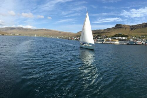
You can go out dining in Gásadalur, Bøur, Sørvágur, at the airport, in Miðvágur and Sandavágur. The café Fiskastykkið in Sandavágur is a cosy place. What used to be a store house for drying fish for export is now a trendy café serving local produce. The fish courses here are phenomenal.
There are lots of opportunities for travellers to go on hiking tours and there are also tour operators arranging epic boat tours. This Boat Tour to Drangarnir is a popular choice among travellers.
Kayaking on the ‘Floating Lake’

Explore Lake Leitisvatn in a kayak for an adventurous time on the lake. Pick up your rented kayak in the old stone houses with turf roof by the lake near the village Miðvágur and you are ready to paddle. Book your Kayaking Tour on Lake Leitisvatn here.
Paddling on the freshwater lake Leitisvatn is quite spectacular. You can even go all the way to the lake’s edge where Bøsdalafossur waterfall plunges into the North Atlantic Ocean. Here you can jump out of the kayak and enjoy sights such as the waterfall and the impressive free-standing rock wall Geituskorardrangur.
Top Attractions on Vágar Island

These are the most popular attractions on Vágar Islands. They are mostly in the western part of the island where the landscape is more rough.
- Múlafossur Waterfall
- Turf houses in Bøur
- View towards Tindhólmur Islet from Bøur
- Boat tour to Drangarnir Sea Arch
- Dunnesdrangar Rock Pillar
- Trælanípa Cliff
- Lake Leitisvatn
- Geituskorardrangur Rock Wall
- Bøsdalafossur Waterfall
- Trøllkonufingur Rock Pillar
Vágar Island is one of the most popular islands in the archipelago for good reason. Now, have you explored the island or are you planning to visit this truly unmatched island with many of the highlights in the Faroe Islands? Start out by browsing the widest selection of things to do and see in the Faroe Islands.
More articles


Popular tours
-
Half-Day Tour on Suðuroy Island
Tour startsSuðuroy IslandDuration4 hours -
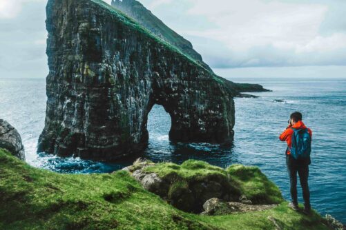
Official 2 Hour Boat Tour & Hiking to Drangarnir Sea Arch
Tour startsSørvágurDuration2 hours -
Private Escorted Tour of main Faroe Islands
Tour startsStreymoy IslandDuration6 hours -
Spellbinding 5 Day Summer Vacation Package of the Faroe Islands
Tour startsTórshavnDuration5 days -
Eat Local on Guided Day Tour
Tour startsTórshavnDuration7 hours -
New Tour
Suðuroy Island | The Photography Tour
Tour startsTórshavnDuration9 hours -
Epic 8 Day Summer Self Drive Tour of Faroe Islands
Tour startsVágar AirportDuration8 days -
Unforgettable 7 Day Summer Package of Faroe Islands
Tour startsVágar AirportDuration7 days -

Unique 1.5 Hour Boat Tour to Drangarnir
Tour startsSørvágurDuration1.5 hours -
Best 7 Hour “All You Can See” Tour
Tour startsTórshavnDuration7 hours -
Vibrant 4 Hour Viðoy Island Tour
Tour startsTórshavnDuration4 hours -
Classic 4 Hour Northern Isles Tour
Tour startsKlaksvíkDuration4 hours -
Private 4 Hour Sailboat Tour to Nólsoy Island
Tour startsTórshavnDuration4 hours -
Refreshing 7 Day Summer Package of the Faroe Islands
Tour startsTórshavnDuration7 days -
Thrilling 7 Hour TROM Sightseeing Tour
Tour startsTórshavnDuration7 hours


Other interesting articles


