Make the most out of your time in the Faroe Island with this 10-day self-drive tour. You will experience all the top attractions over the course of your holiday in the heart of the North Atlantic.
This road trip is designed for those who want to visit as many of the main sights as possible. This extensive tour will let you do just that. You will see as many of the country's natural wonders as can fit into ten days.
The best thing about this self-drive tour is that you decide everything yourself and you can travel at your own pace. You will have the freedom to explore the islands just as you like.
This tour includes 9 nights at a 3* hotel in Tórshavn (upgrade available), a vehicle for 10 days and carefully selected guided tours to the best sceneries in undiscovered nature. Some of the absolute best adventures are included in this package such as ferry tickets to the puffin island Mykines and an exclusive boat tour to the sea arch Drangarnir and countless other attractions.
Find yourself in the middle of untouched nature in the Faroe Islands with this 10-days self-drive tour. Grab the wheel and chance to have the perfect stay in the Faroe Islands. Check availability by choosing a date.
Activities
Bird Watching
Boat Trip
Cultural Activity
Hiking
Sightseeing
Attractions
Borðoy Island
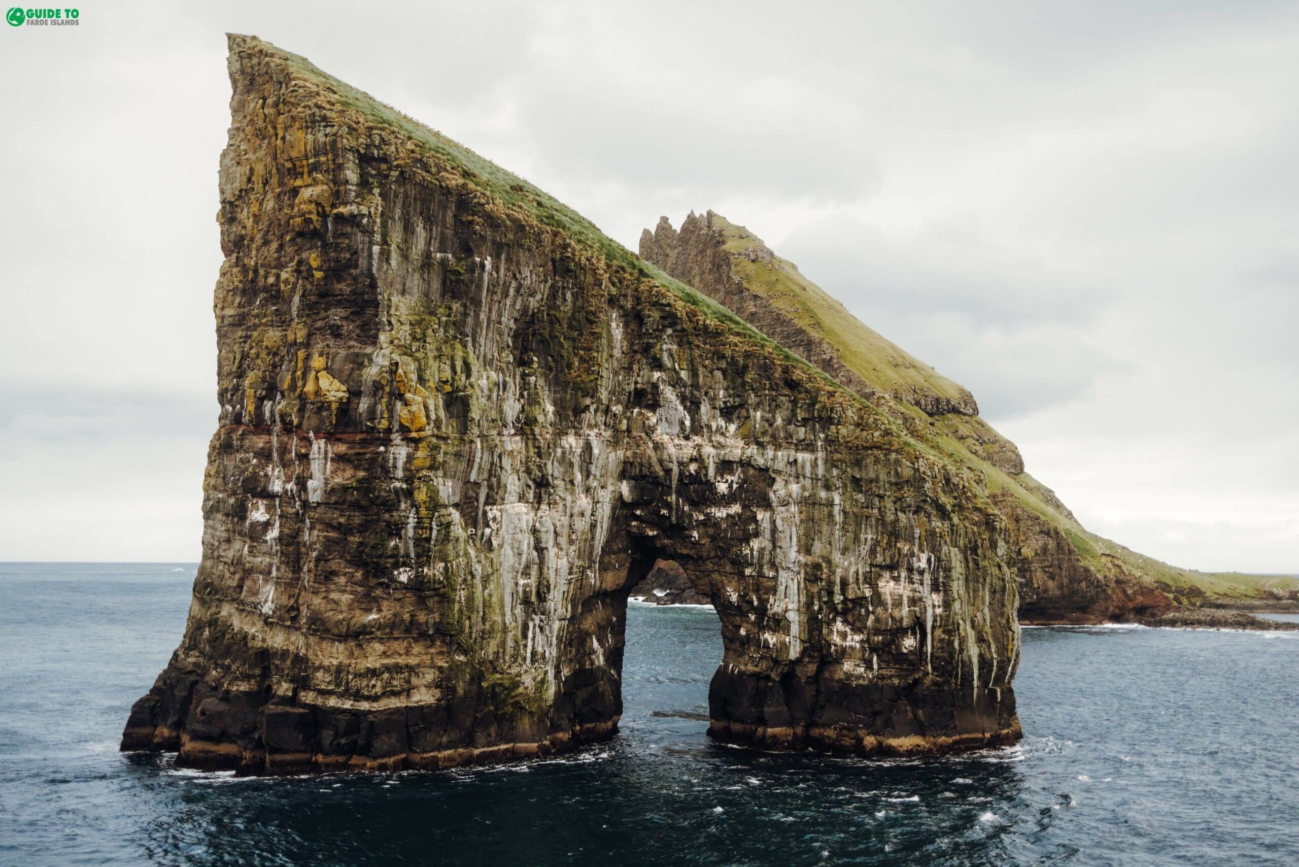
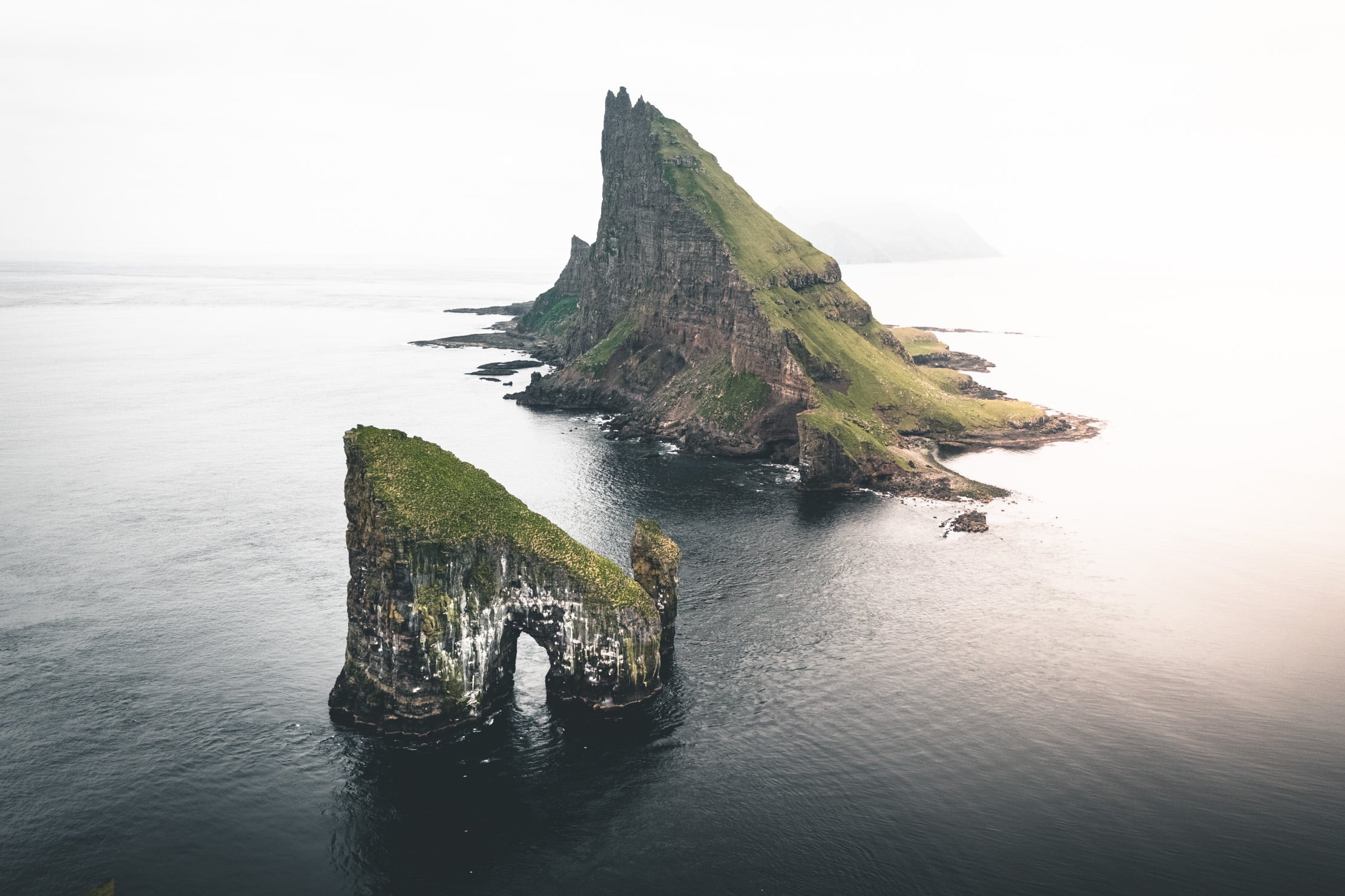
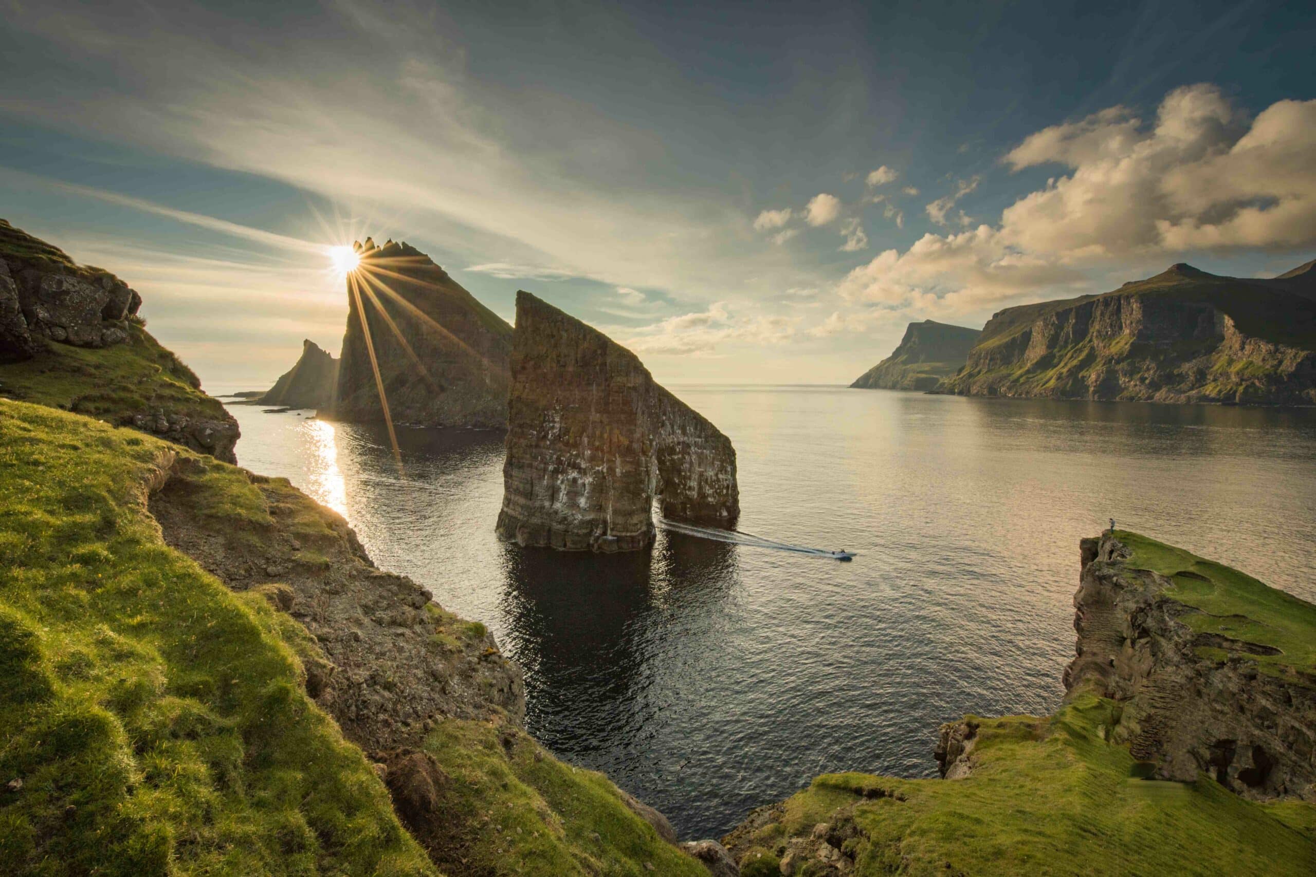
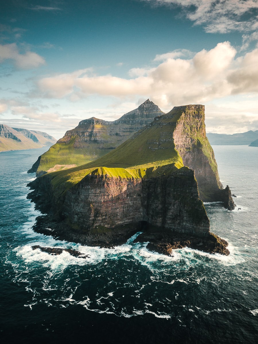
Drangarnir
Eysturoy Island
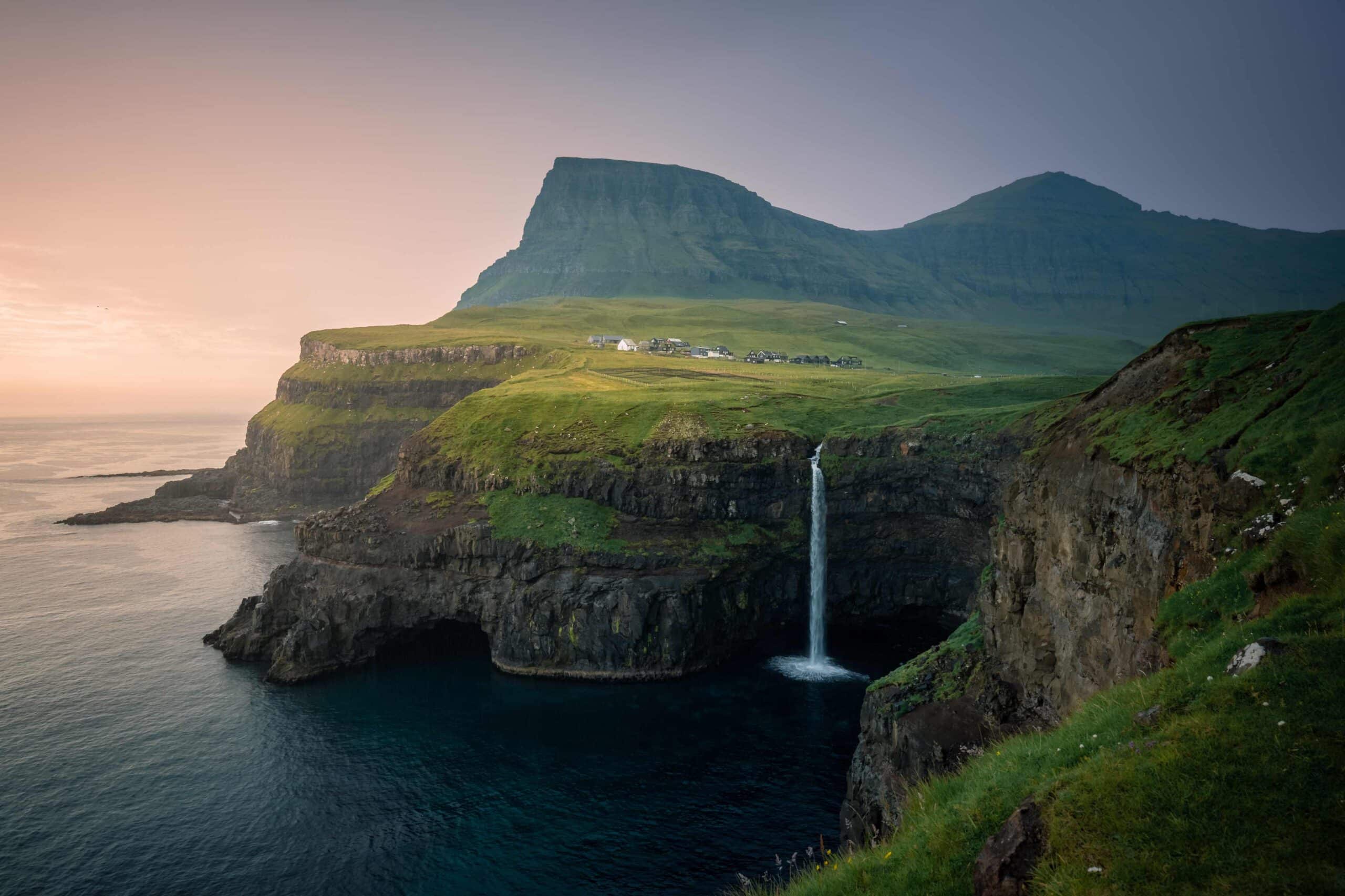
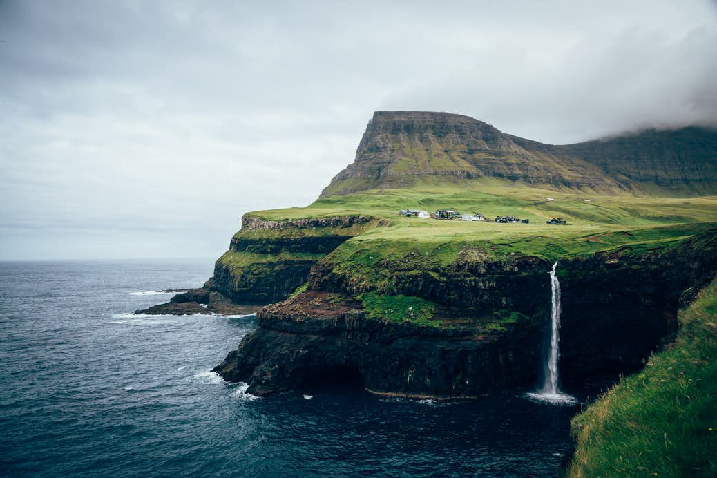
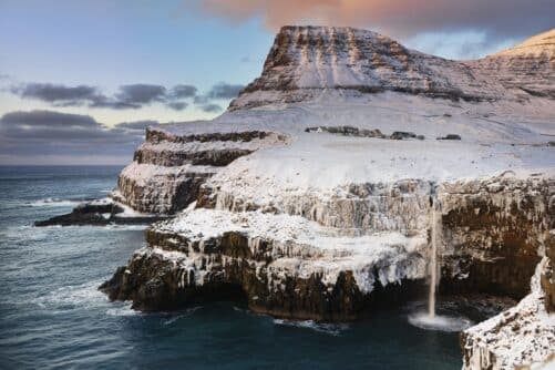
Gásadalur
Gjógv
Kalsoy Island
Kirkjubøur
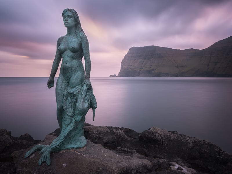
Mikladalur
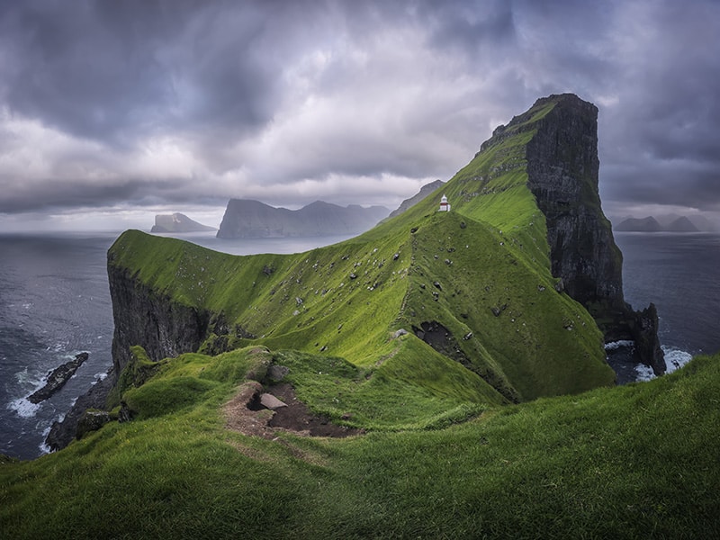
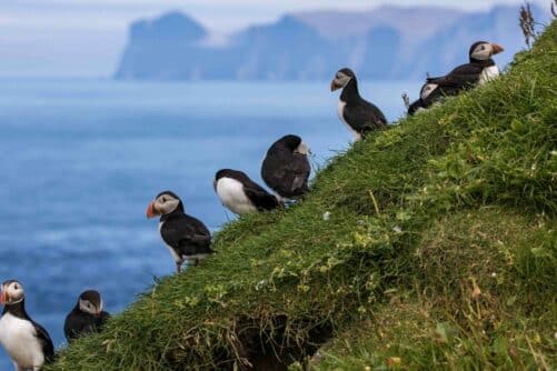
Mykines Island
Risin & Kellingin
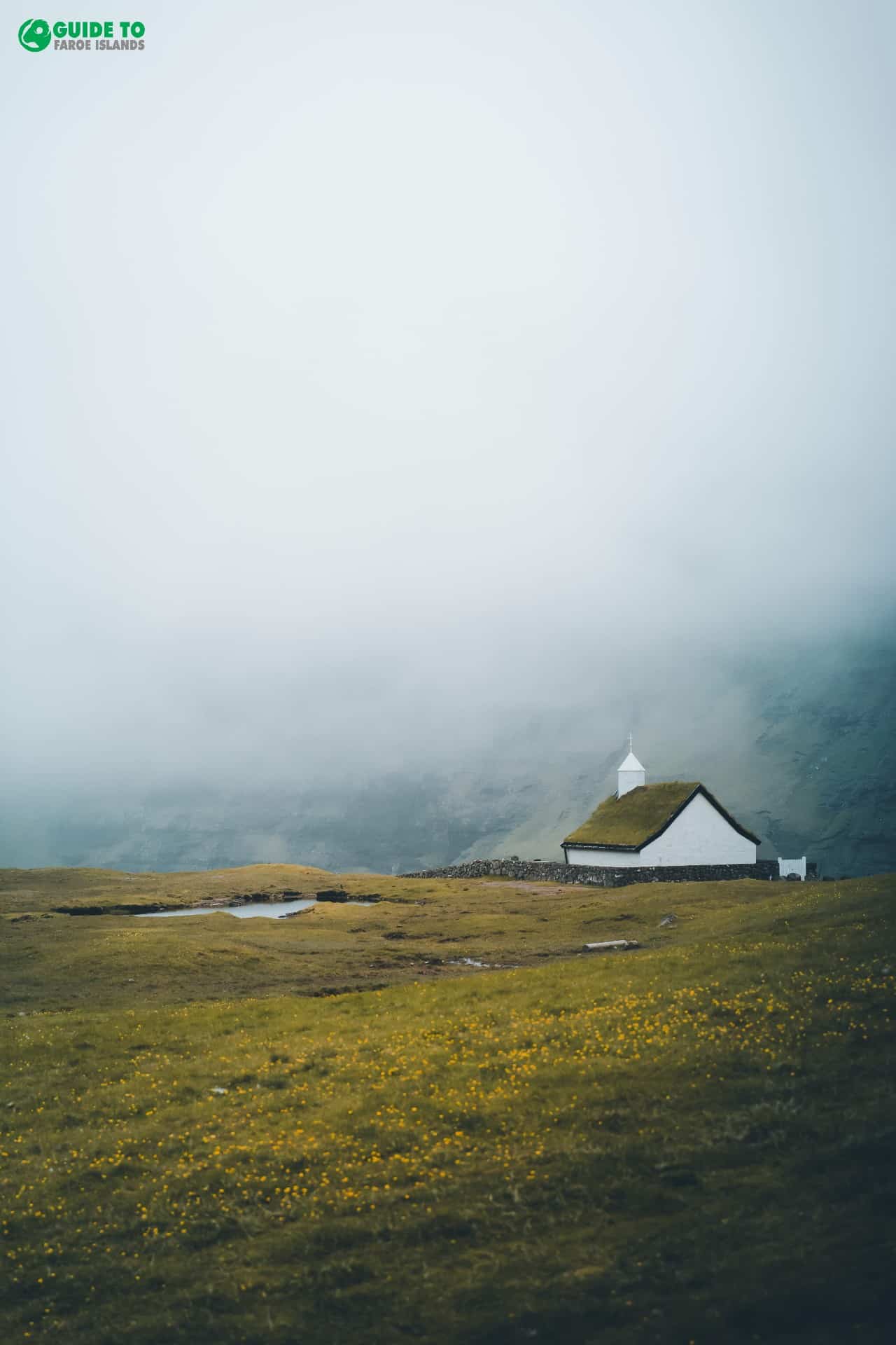
Saksun
Streymoy Island
Suðuroy Island
Tjørnuvík
Trøllanes
Vágar Island
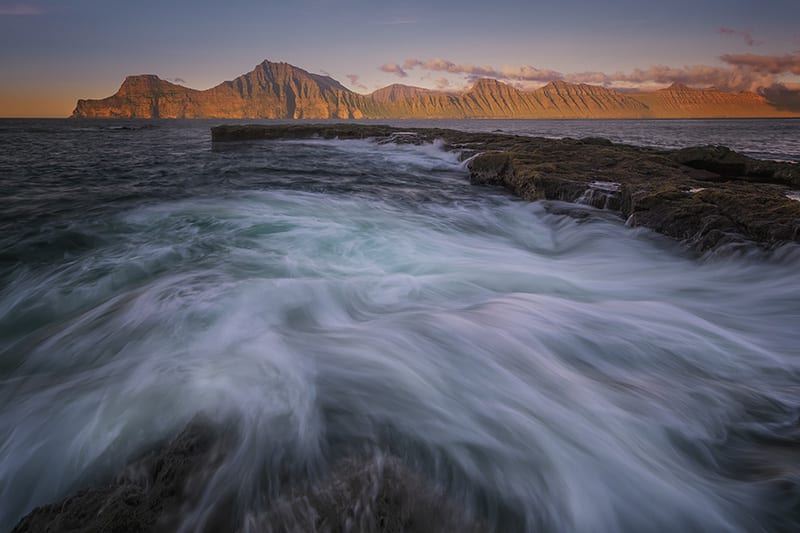
Vestmanna Sea Cliffs
Viðoy Island
Day 1
Arrival in Faroe Islands
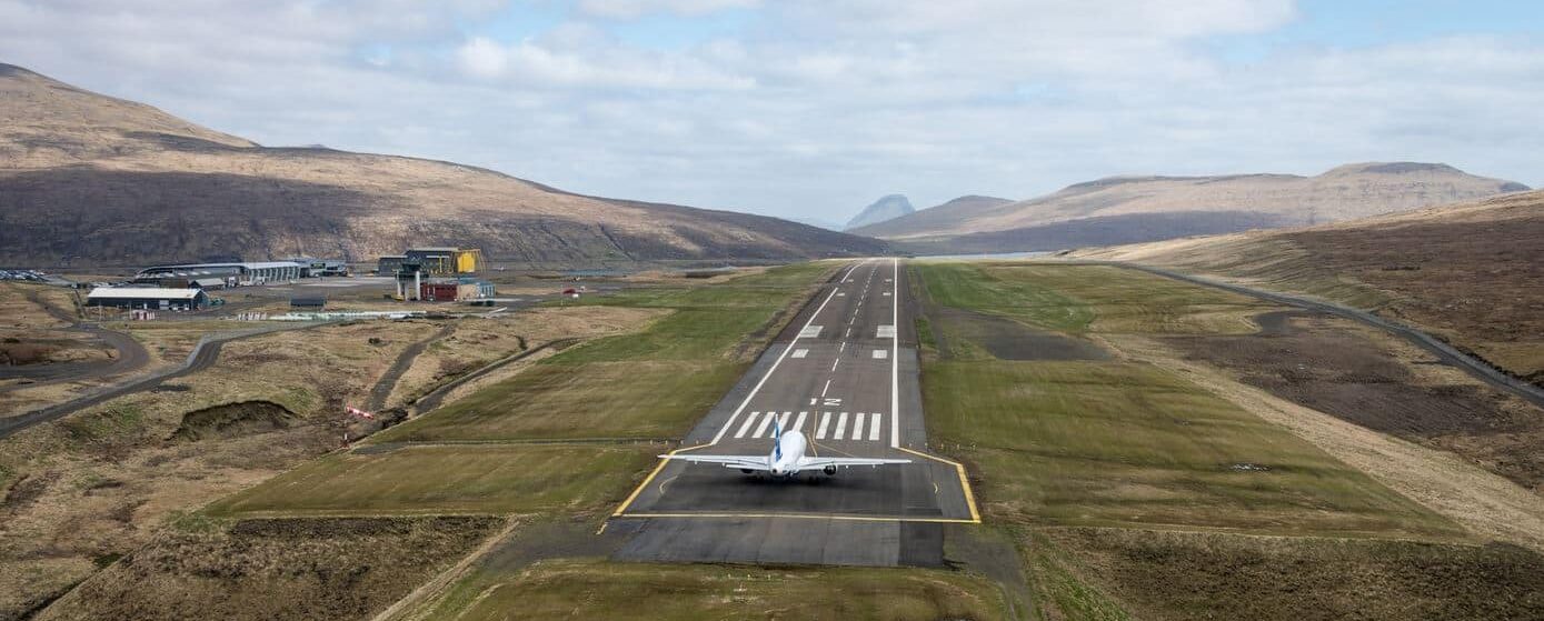
Welcome to the Faroe Islands! Collect your vehicle at Vágar Airport before driving to your hotel in the capital, Tórshavn.
After you have settled in you can start making the most of the cosy capital. There are several great restaurants in the city centre.
Tórshavn is located in the middle of the Faroe Islands and is the perfect base for you to embark on exciting day adventures in the Faroese nature. You will stay at a four star hotel in Tórshavn during your holiday in the Faroe Islands.
Day 2
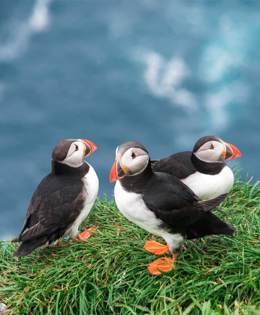
Mykines Island
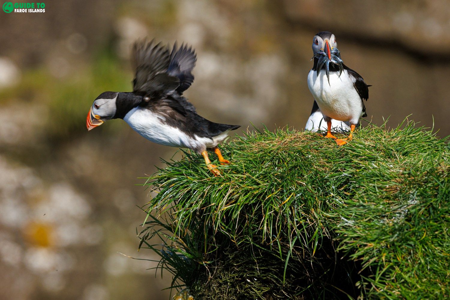
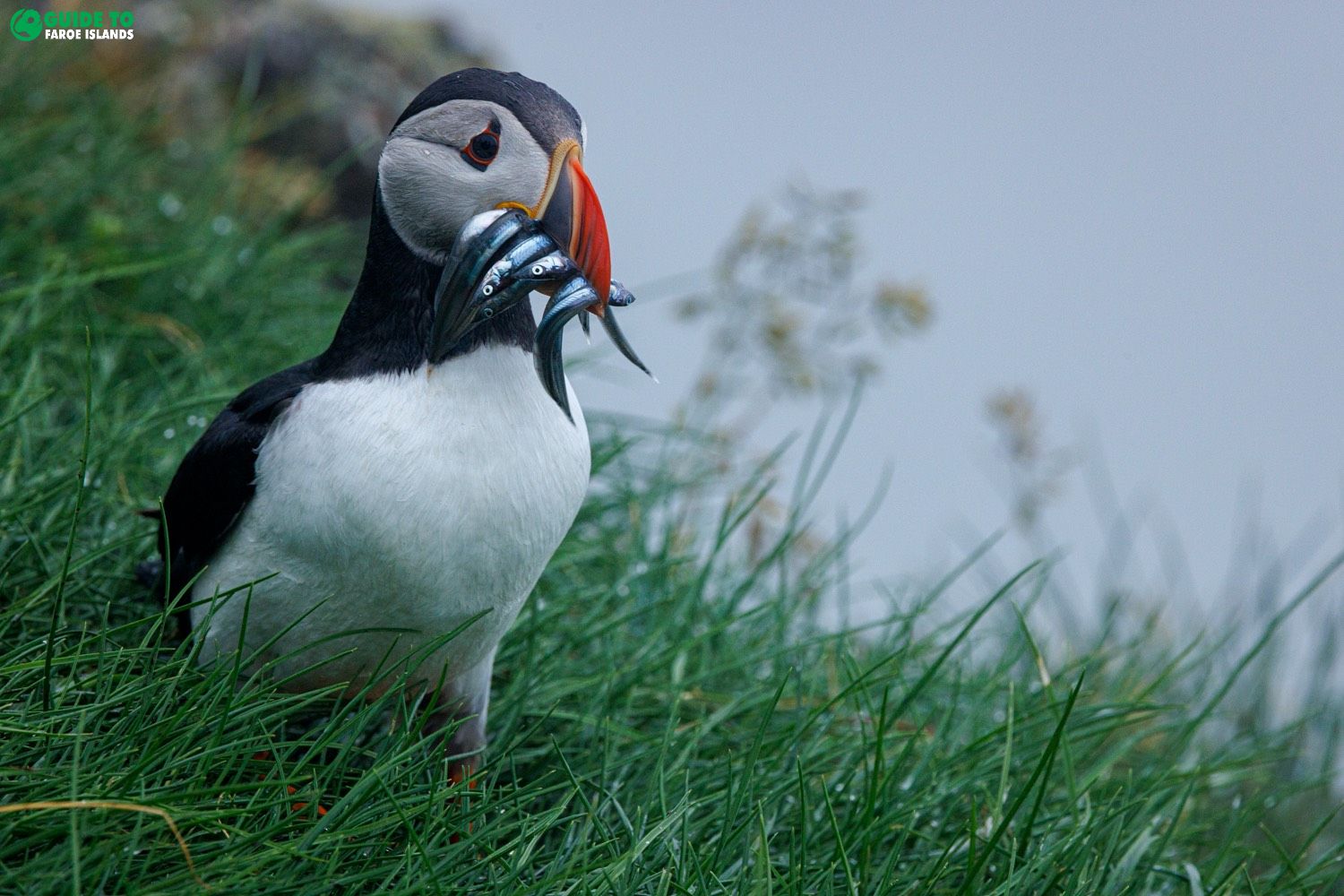
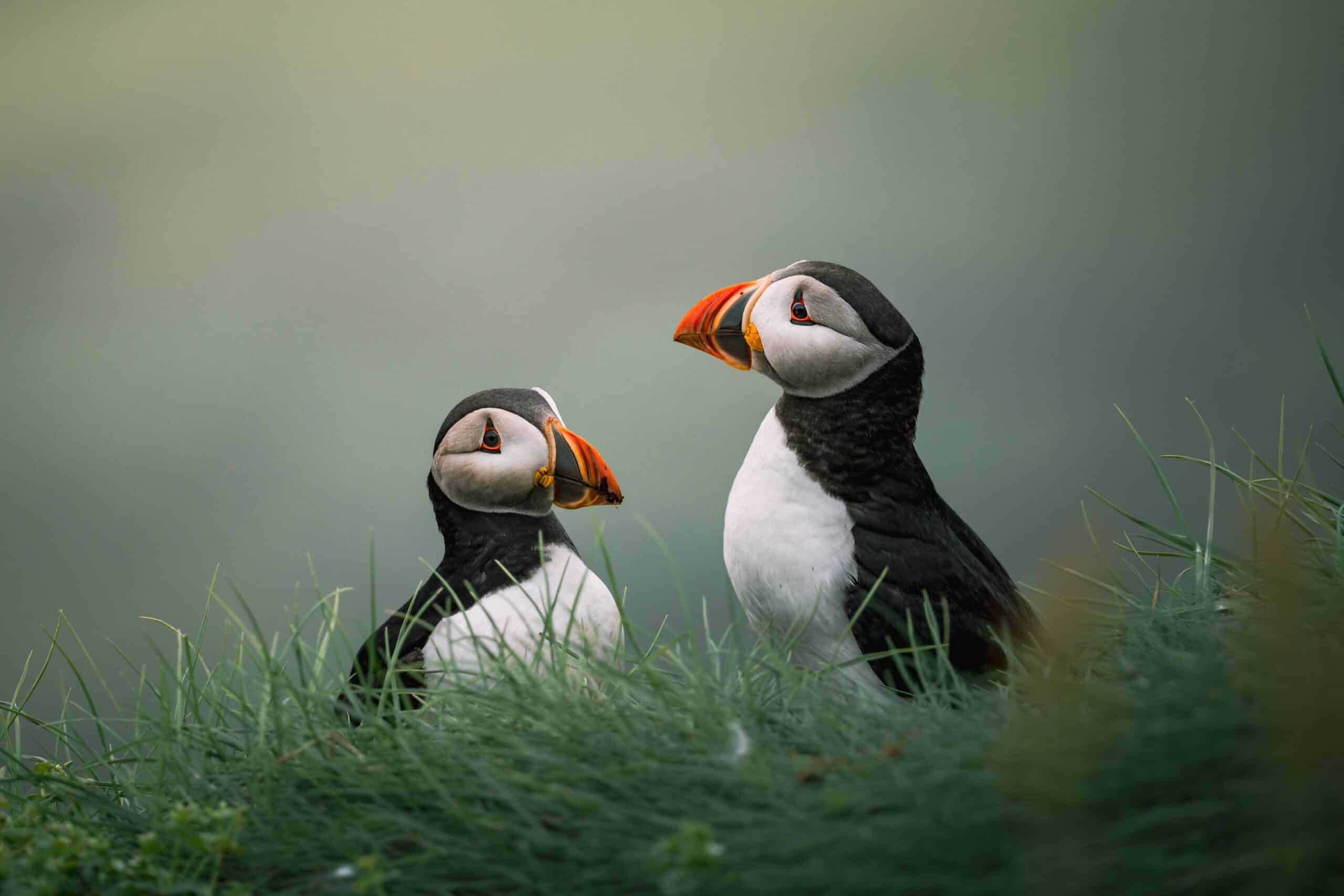
On your second day, you will do a day tour to the most talked about experience in the Faroe Islands: Mykines Island! You will have a whole day in company of the amazingly cute Atlantic puffins.
There are no cars at all on the island Mykines. You will park your car in the village Sørvágur near the airport and take the 45 minutes ferry to Mykines Island. Ferry ticket to Mykines Island is included in the package.
Day 3
Streymoy Island & Eysturoy Island
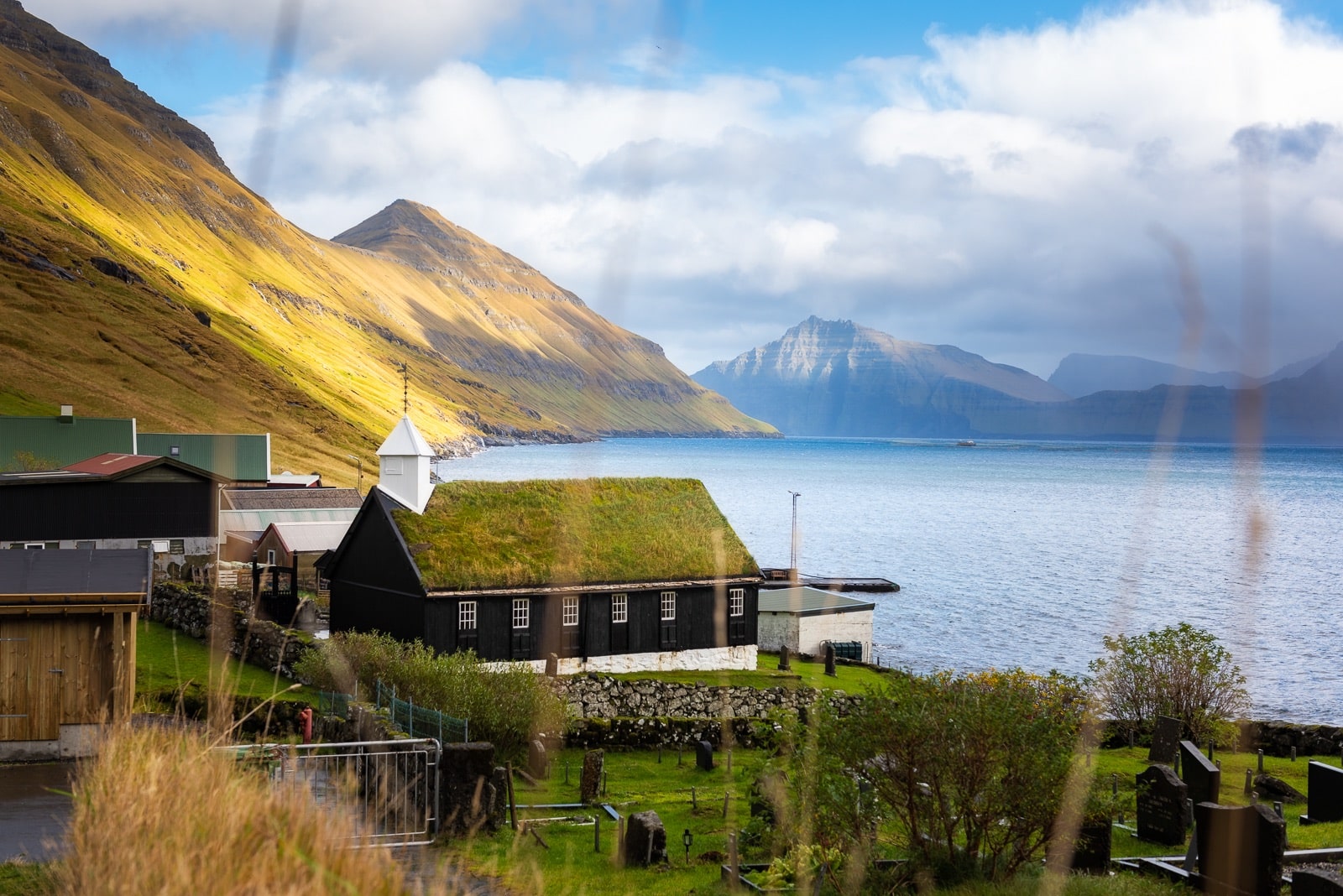
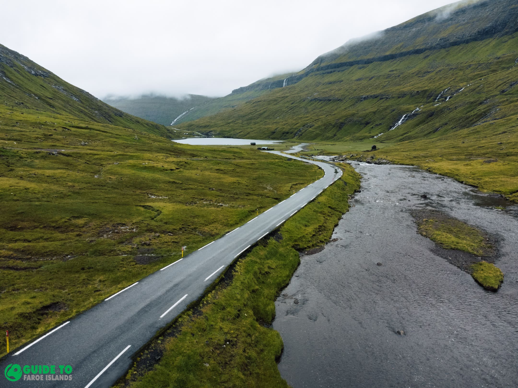
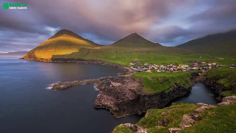
Start your day by driving northbound. You will visit three unbelievable villages on the two main islands Streymoy and Eysturoy.
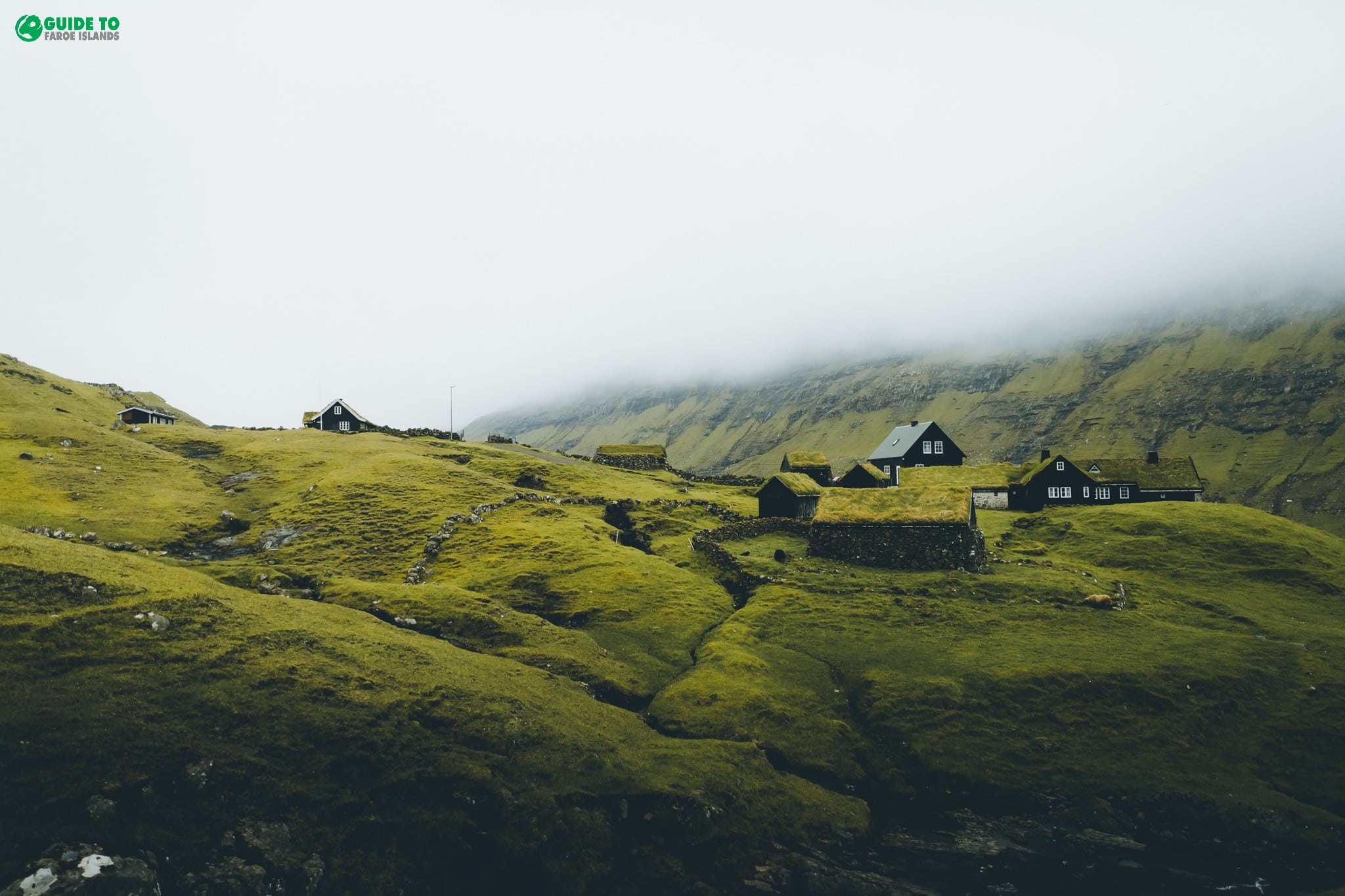
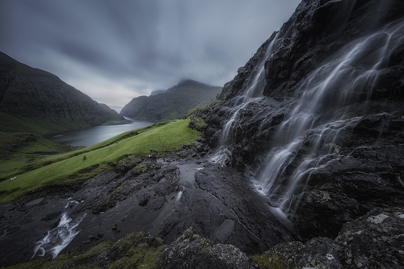
You can spend as much time at each attraction as you prefer. In Saksun you will have an awe-inspiring view of the tidal lagoon and the picturesque turf roofed church. Tjørnuvík is next on schedule and finally Gjógv.
Day 4
Suðuroy Island
Today it is time to take the ferry to the most southernly island Suðuroy. The ferry ride from Tórshavn will take you to exceptional nature on Suðuroy.
You will witness an unparalleled coastline on the west side of the island reachable in your vehicle. From the southernmost tip of the Faroe Islands and the Akraberg lighthouse there to the sea-stack Ásmundarstakkur in the northernly part of the island, Suðuroy is a natural wonder.
You will take the ferry back from the Drelnes ferry port in the evening. After a ywo hours ferry ride, you are back in the capital, Tórshavn.
Day 5
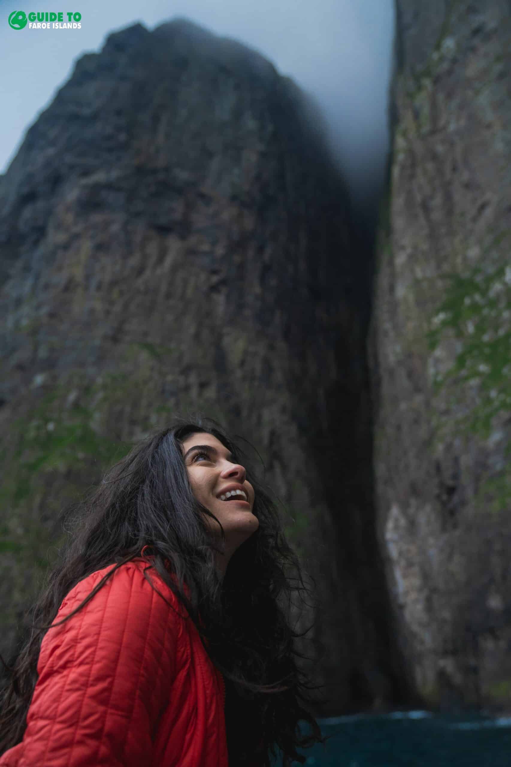
Drangarnir Sea Arch & Vágar Island
On day five, you will drive west to the spectacular Vágar Island. The highlight of the day is a boat tour to Drangarnir Sea Arch.
Before the amazing boat experience, head to the village Gásadalur. Here you will get close to the Múlafossur waterfall that drops into the Atlantic Ocean.
Now, it is time for an exciting boat ride. The boat tour departing from Sørvágur is included in this package.
You will meet the captain at the harbour in Sørvágur at 16:30pm. You will now be taken on an exceptional experience in nature. The duration of the tour will be one hour or so.
Day 6
Kalsoy Island
On your sixth day, you will start travelling north to the undiscovered Kalsoy Island. After a short ferry ride from Borðoy Island, you will enter the island that will bring you top attractions such as Kallur Lighthouse and the turfed houses in the village Mikladalur.
Kalsoy has so much to offer so you will use the day exploring the best sights here. A tour guide will be ready for you, when you reach the northernmost village Trøllanes. From here, you will do a one hour hike that will take you to the breathtakingly beautiful view at Kallurin.
You will take the boat back to Borðoy island in the afternoon. Now, head back to your hotel in Tórshavn.
Day 7
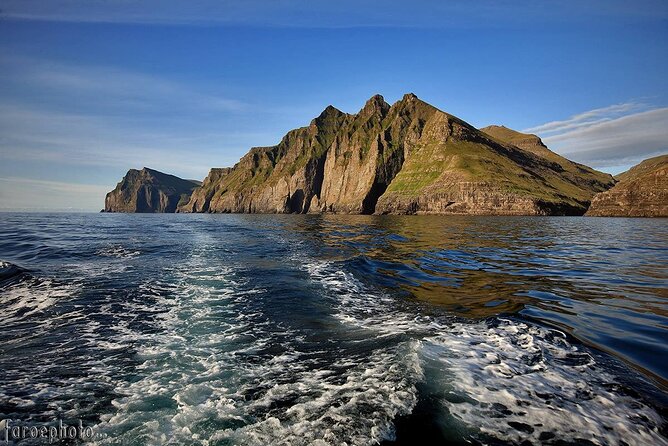
The Vestmanna Sea Cliffs
On your seventh day, you will experience the breathtaking cliffs north of Vestmanna. Take your car to the village Vestmanna and get ready for a two hours boat tour to sheer cliffs and caves.
Vestmanna lies on the same island as your hotel. You will drive in the mountains for 40 minutes before entering the village Vestmanna in amphitheatrical settings.
The boat tour to the cliffs north of Vestmanna is included in this package. You will join the local captain to the unbelievable cliffs. The boat departs from the harbour in Vestmanna. You will be amazed by the scenery and the immense wildlife.
Day 8
The Northern Islands
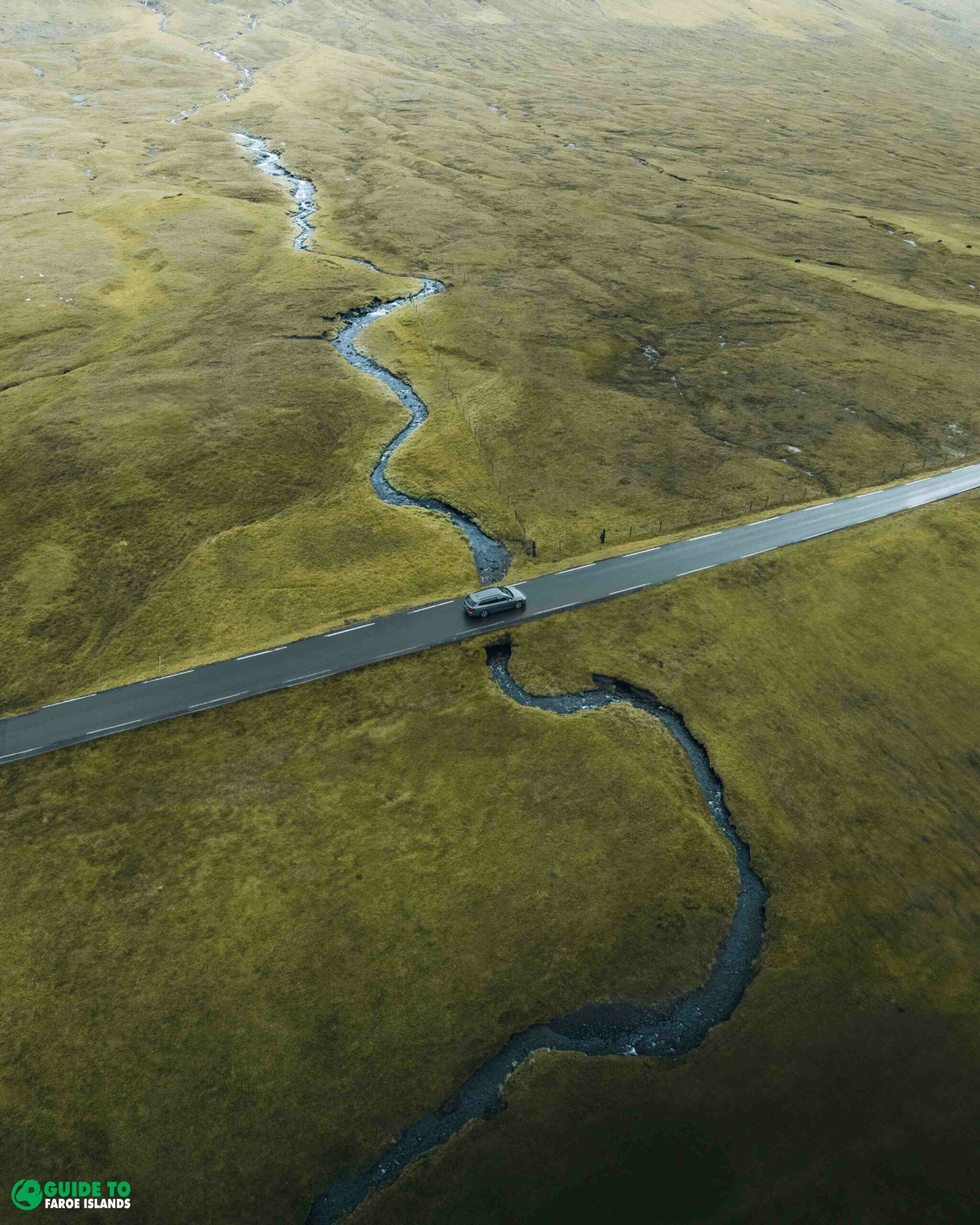
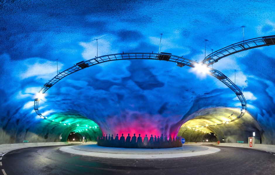
The driving on day eight will take you to the northernmost part of the Faroe islands. You will drive through narrow yet safe tunnels to experience stunning landscapes.
One of the main attractions of the day is the village Viðareiði in absolutely fabulous surroundings. Enjoy the ocean view from the church in the village. Other highlights on this day is the island Kunoy reachable in your car due to two embarkments connecting Viðoy Island to Borðoy Island and another one connecting Borðoy Island to Kunoy Island.
Day 9
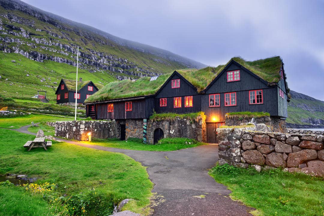
Historic Settlements in Kirkjubøur
Use your ninth day to dig into the history of the Faroe islands. Drive from your hotel to the westside of Streymoy Island. Here you will find the historical village Kirkjubøur with some of the most important historical buildings in the Faroe Islands.
Dig into the hearth of the Faroese heritage Kirkjubø. This is the best place to discover some of the past legends in the Faroe Islands. You will see the ruins of a rock cathedral and you can have a look inside the oldest church in the Faroe Islands dating back to the 11th Century.
Day 10
Farewell to Faroe Islands
It is time to say farewell to the Faroe Islands. Drive from your hotel taking the mountain road when leaving Tórshavn and heading to the airport.
If you leave late, you will have time for some extra sightseeing on Vágar Island. Revisit the spectacular waterfall in Gásadalur only a 20 minutes drive from the airport.
Now it is time to drop off your car at Vágar Airport before departing the Faroe Islands. Enjoy your flight and "síggjast" - see you soon!
Included
9 nights of accommodation in Tórshavn. Breakfast included. (Upgrade available)
En suite bathroom at hotel
Vehicle for 10 days (Ford Fiesta, automatic transmission. Upgrade available)
CDW insurance (which limits own liability to DKK 9500)
Unlimited mileage
3 days with guided tours
Boat tour to Drangarnir Sea Arch
Boat tour to the Vestmanna Sea Cliffs
Ferry ticket to Mykines Island
Ferry ticket to Suðuroy Island
Ferry ticket to Kalsoy Island
Guided hiking tour to Kallur Lighthouse
Hands-on travel agent to oversee your itinerary
Taxes
Cancel your booking and receive a full refund up to 1 week before start of package
Not included
Flights
Fuel
Dinner
What to bring
Driver's License
Warm clothes
Hiking shoes
Additional Information
Will the hotel have a parking area for the car?
Yes, your hotel in Tórshavn comes with free parking.
Will there be restaurants nearby the hotel?
There are restaurants near your hotel within a convenient walking distance.
Do we stay in the same hotel each night?
Yes, you will stay in Tórshavn at the same hotel while in the Faroe Islands.
Is Tórshavn a good place to stay? Tórshavn is very centrally located. You are never more than 1 hour away from the most far-flung corners of the archipelago when staying in Tórshavn.
What hotel is included in the upgrade to a 4-star? This depends on availability. If you have a specific hotel in mind, send us a message before booking. Otherwise, you will get the best hotel in Tórshavn available.
Guide to Faroe Islands offers friendly cancellation policies.
All cancellations must be made by e-mail. Guide to Faroe Islands is making every effort to ensure the best protection for the client in case of cancellations.
Day tours
These terms apply to day tours and activities booked on Guide to Faroe Islands when cancelled by traveller:
a) For cancellations more than 48 hours before the start of the activity, you will receive a full refund.
b) For cancellations 48 hours or less before the start of the activity or in case of no-show, no refund.
Multi-day tours
If you need to adjust your travel plans to the Faroe Islands, please kindly email us and we will try our best to present you with an alternative plan. These terms apply to multi-day tours and vacation packages.
More than 7 days prior to arrival/tour date – 100% refund
3-7 days prior to arrival/tour date – 50% refund
Less than 48 hours prior to arrival/tour date – no refund
Car Rental
Let Guide to Faroe Islands know one week in advance at latest if you need to cancel your car rental and you will receive a full refund..
More than 7 days prior to pickup – 100% refund
3-7 days prior to pickup – 50% refund
Less than 48 hours prior to pickup – no refund
14 reviews for Unforgettable 10 Day Self Drive Tour of Faroe Islands with Top Attractions
Rated 5 out of 5
Patrick Daries –
We were 2 to travel to Faroe Islands and eventually my 2 daughters joined in for the trip. Fortunately, Hogni was very helpful and accomodative having to rearrange 3 times our schedule.
Extremely well organised, very useful web for tips on trails and visits, great guided tour to “James Bond Island” Hogni was always available when there was the slightest contingency (Mykines trip was cancelled because of strong winds), so important when you travel !
And what to say about the Faroe Islands, just dramatic scenery, beautiful landscapes, time stops ticking amidst such nature wonders….
Wonderful experience, thank you to the whole team!
Rated 5 out of 5
Dave Roussy –
We really enjoyed are trip to the Faroe Islands.
Hogni at Guide to Faroe Islands as great to work with and would recommend him to anyone.
Rated 5 out of 5
Joyce Szalwinski –
Had a fantastic time! It’s gorgeous, almost unreal. Thanks for all the help!
Rated 5 out of 5
Chris Taylor –
It’s been fantastic!
Particular thanks for organising everything, and to Marian (I probably have spelled her name wrong) who guided the Kalsoy hike last week.
I’ll definitely be back to the Faroes!
Rated 5 out of 5
Graham O’Shea –
I remember being told by one of the locals “keep this place a secret – we can’t handle more than our current 50,000 visitors per year!”
Therefore I have only secretly told people that I REALLY like to put the Faroes on their travel bucket list – if it isn’t already on it!
Thank you once again to you and your team for your support on such a memorable trip during my time there.
Rated 5 out of 5
Richard Handler –
Torshavn was delightful and the Hotel Foroyar was excellent (clean, comfortable, good food, well staffed).
The itinerary prepared by Guide to Faroe Islands was excellent. Due to inclement weather we deviated twice. Rough seas caused cancellation of the Mykines ferry. We used day 2 to hike along Sorvagsvatn to Traelanipa. Weather on the day we were scheduled to visit Suderoy was also adverse so we instead drove to Gjogv and Vidareidi.
Faroe Island mud is the most slippery we’ve ever encountered. Walking out along the wide flat path to Traelanipa I saw others returning covered in mud, one muddied young woman holding her injured wrist. The ascent of Traelanipa was treacherous with many slipping and falling. Wind velocity there (the day the Mykines ferry was closed) was enough to knock you down. I did not risk getting near the cliff edge for the best photos. The third member of our group is younger (about 70, I am 78) and very strong. She is a triathlete and we are both alpine hikers, accomplished big mountain backcountry alpine and XC skiers with racing backgrounds. In the mud on the Traelanipa walk she suddenly went down in front of me, like a bowling pin. Before getting back in our rental Mazda she sat and bathed in one of the byrnes flowing off the hillside. Unlike the deep mud common in boreal forests, Faroes Isl mud is shallow, but is it ever a lubricant! On the Kallur approach and on the slope of Traelanipa I saw preparations to harden areas of the muddy paths, pallets of plastic mesh plates to place on the surface. This, or crushed rock, is really needed with the number of tourists wearing out the sheep trails.
One of my sudden tumbles, on the descent from the Kallur Lighthouse, was to my left and downhill side (despite poles) landing with a thud more than twice my height down the slope. This resulted in a sprained left wrist, a small fracture in my hand, and a cracked rib. Being a physician I handled this myself until the next day (Saturday) when I explored the outpatient emergency services in the Torshavn hospital. Very clean, relatively fast, not at all busy (unlike U.S. hospitals) and excellent x-ray interpretation by the radiologist. Mainly I sought a velcro closure wrist splint which was more appropriate than a cast, as they in the ER agreed. But the hospital does not have splints! I got a very nice one, inexpensively, at a pharmacy when it opened Monday morning. So visiting the hospital was actually a fun activity for me, given my long career in medicine. I enjoy touring hospitals and clinics more than many museums I’ve been to (so long as it’s not for something serious in the hospital…!).
Wish that the weather had been drier and the winds less dangerous so we could have reached more remote locations, but with the fine itinerary and comfortable hotel, we were pleased we found your company to plan our stay.
Rated 5 out of 5
Kevin Sammut –
Our holiday at the Faroes was amazing.
The Faroe Islands are spectacular.
The accomodation selected for us was very comfortable and the day tours and boat rides booked for us were very enjoyable.
Rated 5 out of 5
Paul Wright –
We are at the airport now feeling sad about leaving the Faroe Islands after 10 wonderful days.
We did Suduroy yesterday, so we completed you 10-day itinerary fully!!! Loved every minute of it.
And every local person we met was friendly helpful and lovely!
We will be back!!!!
Thanks again for your help.
Rated 5 out of 5
Jeronimo Lebrija Villareal –
Thanks for everything, the trip has been the best ever
Rated 5 out of 5
Helen & Kevin Wallis –
Just wanted to say thank you for an amazing trip. All your daily suggested excursions were beyond our expectations.
Rated 5 out of 5
Aya Suzuki –
Thank you for everything, we loved every minute of it!
Rated 5 out of 5
Margaret Gostin –
Thanks for all the communication, you were a great help. We had a great time!
Rated 5 out of 5
Francky Demeester –
Mange takk for your very good care!
We will recommend your services to all we know that want to visit the Faroe islands!
Rated 5 out of 5
Maria Basistova –
Our trip to the Faroe Islands was amazing! Thank you once again for the organization!
We really liked all the activities, especially the trips to Mykines and Kalsoy islands and the hike to Sorvagsvatn.


Patrick Daries –
We were 2 to travel to Faroe Islands and eventually my 2 daughters joined in for the trip. Fortunately, Hogni was very helpful and accomodative having to rearrange 3 times our schedule.
Extremely well organised, very useful web for tips on trails and visits, great guided tour to “James Bond Island” Hogni was always available when there was the slightest contingency (Mykines trip was cancelled because of strong winds), so important when you travel !
And what to say about the Faroe Islands, just dramatic scenery, beautiful landscapes, time stops ticking amidst such nature wonders….
Wonderful experience, thank you to the whole team!
Dave Roussy –
We really enjoyed are trip to the Faroe Islands.
Hogni at Guide to Faroe Islands as great to work with and would recommend him to anyone.
Joyce Szalwinski –
Had a fantastic time! It’s gorgeous, almost unreal. Thanks for all the help!
Chris Taylor –
It’s been fantastic!
Particular thanks for organising everything, and to Marian (I probably have spelled her name wrong) who guided the Kalsoy hike last week.
I’ll definitely be back to the Faroes!
Graham O’Shea –
I remember being told by one of the locals “keep this place a secret – we can’t handle more than our current 50,000 visitors per year!”
Therefore I have only secretly told people that I REALLY like to put the Faroes on their travel bucket list – if it isn’t already on it!
Thank you once again to you and your team for your support on such a memorable trip during my time there.
Richard Handler –
Torshavn was delightful and the Hotel Foroyar was excellent (clean, comfortable, good food, well staffed).
The itinerary prepared by Guide to Faroe Islands was excellent. Due to inclement weather we deviated twice. Rough seas caused cancellation of the Mykines ferry. We used day 2 to hike along Sorvagsvatn to Traelanipa. Weather on the day we were scheduled to visit Suderoy was also adverse so we instead drove to Gjogv and Vidareidi.
Faroe Island mud is the most slippery we’ve ever encountered. Walking out along the wide flat path to Traelanipa I saw others returning covered in mud, one muddied young woman holding her injured wrist. The ascent of Traelanipa was treacherous with many slipping and falling. Wind velocity there (the day the Mykines ferry was closed) was enough to knock you down. I did not risk getting near the cliff edge for the best photos. The third member of our group is younger (about 70, I am 78) and very strong. She is a triathlete and we are both alpine hikers, accomplished big mountain backcountry alpine and XC skiers with racing backgrounds. In the mud on the Traelanipa walk she suddenly went down in front of me, like a bowling pin. Before getting back in our rental Mazda she sat and bathed in one of the byrnes flowing off the hillside. Unlike the deep mud common in boreal forests, Faroes Isl mud is shallow, but is it ever a lubricant! On the Kallur approach and on the slope of Traelanipa I saw preparations to harden areas of the muddy paths, pallets of plastic mesh plates to place on the surface. This, or crushed rock, is really needed with the number of tourists wearing out the sheep trails.
One of my sudden tumbles, on the descent from the Kallur Lighthouse, was to my left and downhill side (despite poles) landing with a thud more than twice my height down the slope. This resulted in a sprained left wrist, a small fracture in my hand, and a cracked rib. Being a physician I handled this myself until the next day (Saturday) when I explored the outpatient emergency services in the Torshavn hospital. Very clean, relatively fast, not at all busy (unlike U.S. hospitals) and excellent x-ray interpretation by the radiologist. Mainly I sought a velcro closure wrist splint which was more appropriate than a cast, as they in the ER agreed. But the hospital does not have splints! I got a very nice one, inexpensively, at a pharmacy when it opened Monday morning. So visiting the hospital was actually a fun activity for me, given my long career in medicine. I enjoy touring hospitals and clinics more than many museums I’ve been to (so long as it’s not for something serious in the hospital…!).
Wish that the weather had been drier and the winds less dangerous so we could have reached more remote locations, but with the fine itinerary and comfortable hotel, we were pleased we found your company to plan our stay.
Kevin Sammut –
Our holiday at the Faroes was amazing.
The Faroe Islands are spectacular.
The accomodation selected for us was very comfortable and the day tours and boat rides booked for us were very enjoyable.
Paul Wright –
We are at the airport now feeling sad about leaving the Faroe Islands after 10 wonderful days.
We did Suduroy yesterday, so we completed you 10-day itinerary fully!!! Loved every minute of it.
And every local person we met was friendly helpful and lovely!
We will be back!!!!
Thanks again for your help.
Jeronimo Lebrija Villareal –
Thanks for everything, the trip has been the best ever
Helen & Kevin Wallis –
Just wanted to say thank you for an amazing trip. All your daily suggested excursions were beyond our expectations.
Aya Suzuki –
Thank you for everything, we loved every minute of it!
Margaret Gostin –
Thanks for all the communication, you were a great help. We had a great time!
Francky Demeester –
Mange takk for your very good care!
We will recommend your services to all we know that want to visit the Faroe islands!
Maria Basistova –
Our trip to the Faroe Islands was amazing! Thank you once again for the organization!
We really liked all the activities, especially the trips to Mykines and Kalsoy islands and the hike to Sorvagsvatn.